
The pre-monsoon churn over north India has picked up pace. In Haryana, on-and-off showers over the past few days have handed people a welcome break from the scorching heat, with the steady rain pulling the mercury down by 4.9 degrees. In the hill state of Himachal Pradesh, meanwhile, the clouds are bursting hard enough that the weather office has flagged seven districts at once.
What Haryana Can Expect Today
According to the India Meteorological Department (IMD), Haryana's weather will keep swinging until June 17, with the direction and speed of the winds changing constantly through this stretch. Even so, most parts of the state are likely to feel a touch warmer than normal today, June 15. A few places could see patchy clouds and light rain by evening, nudging temperatures slightly lower.
The IMD notes that the southwest monsoon is sweeping rapidly across several parts of the country. In step with that, Haryana is expected to see thunderstorms, lightning and gusty winds blowing at 40 to 50 kilometres per hour today. Through June 17, conditions will stay broadly unsettled, and with a marginal rise in daytime temperatures likely, intermittent patchy clouds and scattered drizzle remain on the cards.
The Day-by-Day Forecast Ahead
The weather office has also laid out the picture for the coming week. On June 16, a few districts in northern and eastern Haryana are likely to see clouds along with light drizzle. June 17 should stay pleasant across many areas, with light rain and thundershowers in some pockets. On June 18, the weather is set to turn once more — daytime humidity may climb, but strong winds and rain are forecast for some places by evening.
After that, June 19 will keep clouds moving over southern and western Haryana, with light to moderate rain possible in spots. Many districts will feel cooler on June 20, while a fresh round of rain is expected in some districts on June 21.
Tracking the Monsoon's Progress
The monsoon is running behind its usual schedule this year. For now it has pushed into parts of Jharkhand and Odisha, and is expected to reach Madhya Pradesh within the next 3 to 4 days. Notably, after making landfall in Kerala on June 4, the monsoon has covered 19 states in just 9 days.
Why Caution Matters Right Now
Given the threat of thunderstorms and heavy rain, the weather department has urged people to take precautions. Strong winds could snap tree branches and damage kutcha houses, so residents have been advised to stay indoors during bad weather, keep away from electrical appliances and avoid sheltering under trees.
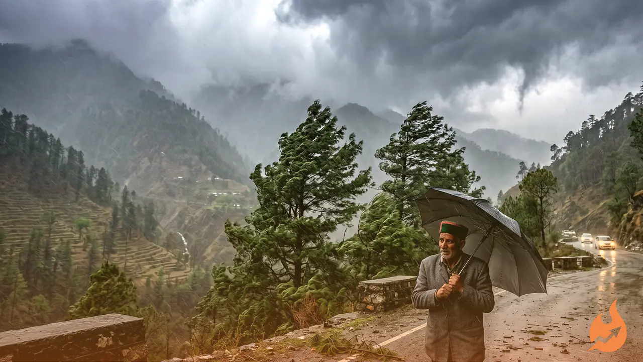
Himachal Set for Rain Through June 20
Himachal Pradesh is expected to get heavy rain again today, June 15. The state weather department has issued a yellow alert for the districts of Shimla, Kullu, Mandi, Solan, Kangra, Sirmaur and Chamba, where thunderstorms, gusty winds and lightning are likely at various points through the day. Light rain could continue across most of the state until June 20. Over the next few days, the minimum temperature is expected to rise by 2°C to 5°C and the maximum by 4°C to 8°C.
How the Last 24 Hours Played Out
Over the past 24 hours, some parts of Himachal saw light to moderate rain while most areas stayed dry. The minimum temperature across the state dropped by 2°C to 5°C, settling between 6°C and 23°C, while the maximum fell by 2°C to 7°C, ranging from 13°C to 37°C.
Looking at the day's high temperatures in key towns: Shimla recorded 25.6°C, Dharamshala 30°C, Solan 28°C, Kangra 32.2°C, Mandi 34.2°C, Sundernagar 33.1°C, Kufri 19.3°C, Bhuntar 32.2°C, Kalpa 21.8°C, Keylong 18.8°C and Nahan 30°C.