
As the monsoon rains bring relief from the scorching heat, they also trigger a significant rise in snake encounters across various regions. Flooded holes and burrows force these reptiles to seek dry shelter, often leading them into residential zones, agricultural fields, and gardens. For those living in rural areas or working outdoors, this seasonal shift demands heightened vigilance. Fortunately, modern mobile technology is stepping up to address this challenge by providing real-time data on nearby reptile activity. An expert in snake conservation from Prayagraj has highlighted how a specialized digital tool is helping communities stay informed and safe.
The Digital Mapping Tool for Reptile Sightings
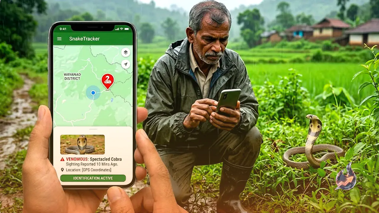
The application, widely known as Big 4 Mapper and now updated in several regions as SERPENT by Indiansnakes, utilizes advanced mapping and GPS technology to track snake encounters. This platform functions on a crowdsourced model where individuals can upload details, including the geographical location and images, of any snakes they spot. This compiled data creates an interactive map, allowing other residents to see exactly where various species have been active recently. By accessing this collective database, individuals can identify high-risk areas in their immediate vicinity, whether they are navigating village paths or managing vast farmlands.
Who Stands to Benefit the Most?
This technological solution is highly advantageous for specific groups of people who are more exposed to outdoor environments. Farmers working in crop fields, residents living near dense forests, outdoor trekkers, and people who must travel on foot during the dark night hours will find this tool incredibly valuable. During the monsoon, when snakes are highly active, knowing which fields or pathways have prior sightings helps these individuals take preventive measures. It is important to note that the application does not predict future movements or guarantee an area is completely free of reptiles, it simply offers a historical record of reported sightings to foster better situational awareness.
Educating Users on Snake Identification
A major cause of panic during a snake encounter is the inability to distinguish between venomous and non-venomous species. To mitigate this fear, the application includes an extensive library filled with high-resolution photographs and detailed descriptions of diverse snake species. By studying these educational resources, users can learn to identify common reptiles and avoid unnecessary panic. However, safety experts strongly emphasize that under no circumstances should an untrained person attempt to handle, capture, or closely approach an unidentified snake, regardless of what the digital guide suggests.
Crucial Emergency Steps and Expert Advice
In the unfortunate event of a snakebite, relying solely on a mobile application is extremely dangerous. The primary and most urgent action must be transporting the victim to the nearest hospital immediately. Administering professionally supervised anti-snake venom is the only scientifically proven cure for a venomous bite. While many modern safety applications provide basic first aid guidelines, they should never be viewed as a substitute for professional medical intervention.
According to safety experts, taking basic precautions remains the best defense during the rainy season. Residents should clear wild bushes and tall grass from around their homes, always carry a bright torch when walking after sunset, wear sturdy knee-high boots when entering fields, and thoroughly inspect any dark crevice or pile of wood before reaching in with bare hands. While digital innovation plays a vital role in building public awareness, personal caution and timely medical action remain the ultimate shields against snakebites.