
















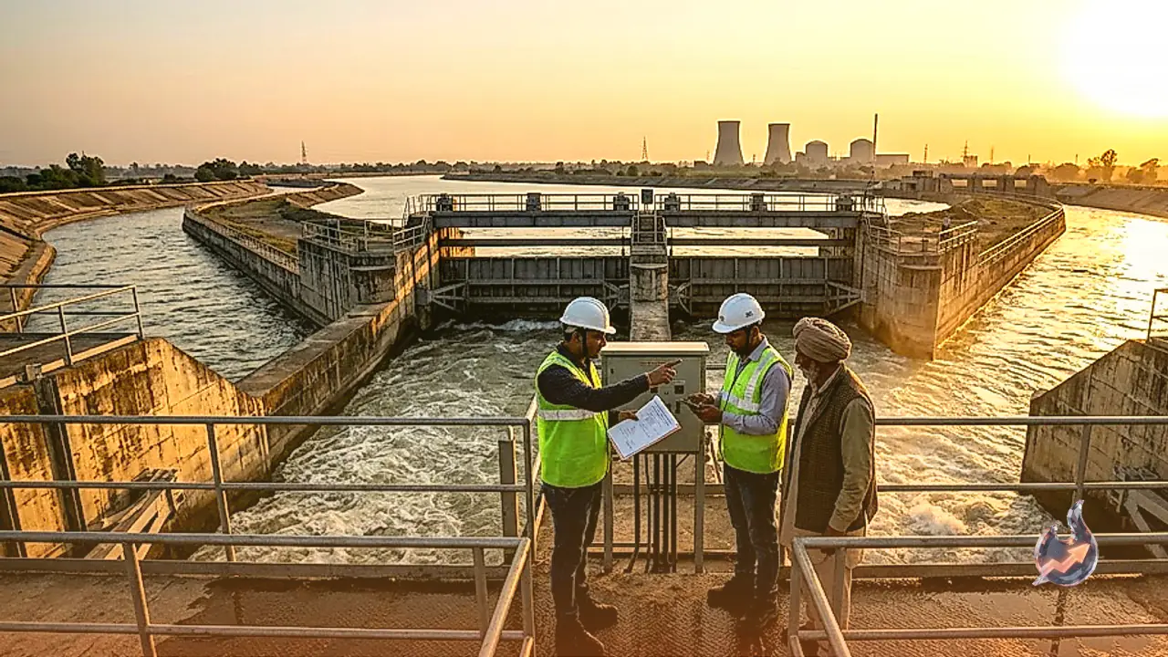

In the vibrant town of Tohana, located in the dynamic state of Haryana, an extraordinary feat of engineering seamlessly blends with the natural scenic beauty of the region. Visitors who travel to this unique intersection are often captivated by the sight of lush green trees, the rhythmic sound of rapidly flowing water, and the melodic chirping of local birdlife. Adding to this remarkable spectacle is a towering railway bridge, where trains thunder directly over a massive water regulation system. This intricate junction, widely celebrated and affectionately known as the 'City of Canals', serves as the origin point for eight distinct water channels. Known officially as the Tohana Regulator Head, or sometimes referred to as the Baliyala Head, this sprawling location is the beating heart of a vast irrigation network. It is precisely because of this extensive web of waterways that the historically arid and dry fields of both Haryana and Rajasthan have been successfully transformed into thriving, fertile agricultural lands.
A Historic Deal With Prime Minister Nehru
The fascinating origins of this magnificent hydraulic structure trace back to the critical years immediately following India's independence. In 1948, the monumental Bhakra Nangal Dam project was formally initiated to harness the torrential waters of the northern rivers. The immense responsibility for overseeing this massive national undertaking was handed to Chief Engineer Rai Bahadur Kanwar Sain Gupta, who coincidentally happened to be a native of Tohana. Historical accounts and local lore suggest that while Gupta was fully committed to executing the ambitious dam project, he placed a specific, unyielding condition before the then Prime Minister Jawaharlal Nehru. The engineer insisted that a highly sophisticated regulator head must be constructed in his hometown as part of the broader irrigation blueprint. Recognising the engineer's undeniable brilliance and the project's overarching national importance, Nehru agreed to the terms. Gupta then dedicated three years of relentless hard work to realise the Nangal Dam, simultaneously ensuring that the complex Tohana Head was built to sheer perfection.
The Lifeline of Two Northwestern States
The Bhakra Nangal Dam, situated strategically on the rushing Sutlej river along the border of Himachal Pradesh and Punjab, stands out as a true national marvel. Recognized officially as the longest dam in the country, it also proudly holds the title of India's second-highest dam, trailing only behind the towering Tehri Dam, and ranks third globally in terms of height. In 1954, Prime Minister Nehru inaugurated the main branch of this sprawling canal system, an event that fundamentally altered Haryana's agricultural destiny for the better. Historical timelines indicate that by 1963, the life-giving waters of the Bhakra canal finally arrived in full force at Tohana. Today, the formidable Baliyala Head efficiently divides this massive, surging flow. From this central hub, eight different channels fan out to quench the thirst of distant parched lands. Significant regional waterways like the Fatehabad Branch, the Ratia canal, and the Barwala canal distribute water extensively within Haryana, crucially serving drought-prone districts like Sirsa. Meanwhile, the Sidhmukh Branch and another major conduit deliver essential, consistent irrigation to the expansive Ganga canal network stretching into neighboring Rajasthan.
Engineering Marvels and Local Tourist Attractions
Beyond its immense agricultural and economic impact, the localized infrastructure at the Tohana intersection is genuinely remarkable in its own right. The area features a picturesque, well-maintained guest house that sits alongside a dedicated meter house. This technical facility was specifically designed to precisely measure the heavy flow of water in cusecs. This vital measuring station ensures that the immense volume gushing through the Bhakra main branch is accurately monitored and regulated before it diverges into smaller streams. The striking convergence of five to seven canals meeting at a single point, combined with intersecting road junctions and the overhead railway bridge, creates a visually stunning and dynamic environment. Consequently, this engineering marvel has steadily evolved into a popular regional tourist destination, drawing curious visitors and hydrology enthusiasts who want to witness the harmonious blend of human structural ingenuity and raw natural flow.
Fueling North India's First Nuclear Plant
The strategic significance of the Tohana hub continues to grow exponentially with the nation's modern infrastructural and energy demands. In a fascinating and futuristic recent development, a highly specialized water channel has been carved out directly from this headworks to supply critical resources to Gorakhpur village, located deep in the Fatehabad district. This particular channel is no ordinary agricultural irrigation ditch; it has been engineered to travel completely underground for a massive stretch of exactly 50 kilometers. Its ultimate, high-stakes destination is the Gorakhpur Haryana Anu Vidyut Pariyojana (GHAVP), which is currently under rapid construction as North India's premier atomic power plant. Backed by a massive federal budget of approximately ₹42,000 crore, the cutting-edge facility is designed to generate a staggering 2800 MW of clean electricity. Current projections indicate that the plant's first two nuclear units are expected to become fully operational by the year 2031. The uninterrupted, subterranean water supply originating from the Tohana Head will be absolutely crucial for the cooling towers and the safe, daily operation of this monumental atomic project.