























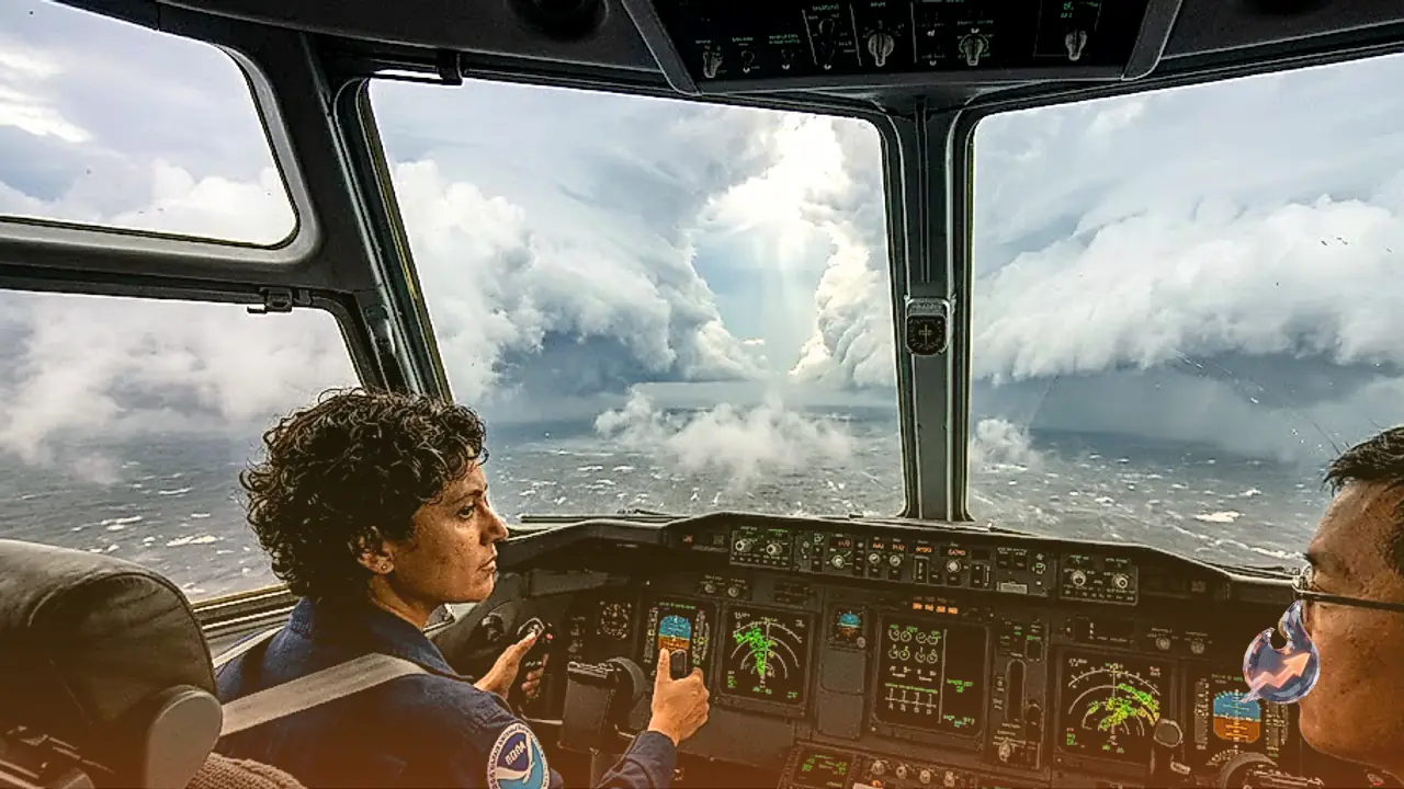

Winds whipping at two hundred sixty kilometers per hour, dense walls of brown and gray clouds, and an aircraft navigating through the severe turbulence might sound like a scene from a Hollywood thriller. However, this breathtaking reality was captured by scientists at the United States weather agency NOAA, who flew an airplane straight into the very core of a catastrophic Category 5 cyclone named Polo. The brave researchers known as hurricane hunters steered their specialized aircraft right into the center of the massive storm to gather crucial meteorological data.
Flying through violent cloud walls into the calm eye
The historical flight inside Hurricane Polo took place on September 22. Footage shared on social media clearly demonstrates how the aircraft initially pushed through a dense and menacing wall of white clouds known as the eyewall. During this phase, severe turbulence battered the cabin, making visibility outside nearly impossible. Yet the moment the plane broke through that ferocious barrier and entered the exact center or eye of the storm, the environment transformed completely into absolute stillness.
A clear blue sky abruptly emerged overhead, surrounded on all sides by a towering circular wall of clouds. The formation resembles a colossal stadium with an open roof and walls made of towering cloud banks. Meteorologists refer to this unique phenomenon as the stadium effect, which typically manifests only within exceptionally powerful cyclones.
Specialized Lockheed aircraft and data gathering instruments
While commercial passenger flights routinely alter their routes at the mere mention of severe weather, this specialized aircraft is designed to approach the storm directly. The mission was executed using a specialized Lockheed WP-3D Orion aircraft. NOAA operates two such meteorological planes, one of which is affectionately nicknamed Miss Piggy. These aircraft differ significantly from standard commercial jets, featuring reinforced structural integrity built to withstand extreme wind loads and atmospheric pressure.
Satellites can observe cyclones exclusively from above, but these aircraft penetrate the interior to measure wind velocity, air pressure, temperature, and humidity accurately. The plane deploys specialized sensors called dropsondes into the storm. These compact instruments descend via parachutes, measuring atmospheric fluctuations at every level and transmitting real-time data directly to the onboard computer systems. Supercomputers then process this precise information to forecast the future path and destructive potential of the storm.
The raw power of Hurricane Polo and views from space
During the research flights inside Polo, the system was operating at its most ferocious intensity. According to the National Hurricane Center, Hurricane Polo attained Category 5 status by September 24, generating core wind speeds reaching two hundred sixty kilometers per hour. Such velocity is capable of uprooting massive trees and tossing vehicles and structures aside with ease. Subsequent reports later indicated a slight reduction in wind speed to two hundred forty kilometers per hour, corresponding with an eyewall replacement cycle where the inner cloud boundary rebuilds itself.
While the storm churned below, astronauts aboard the International Space Station captured stunning visual perspectives from hundreds of kilometers above Earth. NASA astronaut Jessica Meir utilized the cupola window to document the sheer scale of Hurricane Polo, noting from orbit that the weather system appeared immense and ominous. She shared close-up imagery of the distinct eye surrounded by rotating cloud bands, stating intentions to capture additional imagery during subsequent orbital passes.
Coastal impacts and warnings for Mexico
Regarding its trajectory, Hurricane Polo has been hovering near the southwestern coast of Mexico. Recent updates place the system approximately three hundred fifteen kilometers southwest of Manzanillo, Mexico, tracking steadily toward the west. Although the primary center remains offshore, peripheral impacts are already affecting coastal regions.
Torrential rainfall has commenced across southwestern portions of Mexico due to the outer bands of Polo. Mountainous areas face heightened risks of severe landslides and sudden flash flooding from the continuous downpour. Weather forecasters project that the cyclone could potentially regain Category 5 strength before initiating a gradual weakening trend.