





















When Mount Pinatubo violently erupted in 1991, the consequences were devastating. Over 800 people lost their lives, primarily because the accumulation of heavy volcanic ash, saturated by monsoon rains, caused residential roofs to collapse. Yet, the tragedy could have been far worse. Approximately 250,000 residents lived in the immediate vicinity of the volcano, spread across several growing urban areas and a massive US Air Force installation. When the volcano began experiencing deep tremors and releasing steam in April of that year, scientists from the United States and the Philippines acted quickly to install an array of monitoring equipment to track the subterranean unrest.
Mike Poland, the scientist in charge at the US Geological Survey’s Yellowstone Volcano Observatory, notes that very little was known about Pinatubo at the time. This lack of historical data necessitated an incredibly rapid geological assessment. The findings of that evaluation were stark: when this particular volcano erupted, it did so with immense force. This crucial finding became the cornerstone of the subsequent hazard forecast. By early June, the volcano was discharging ash and lava, leading to an evacuation order just days before the cataclysmic eruption occurred. It was a remarkably close call that demonstrated the power of scientific intervention.
While those monitoring efforts successfully saved thousands of lives, the forecast itself was more of an educated guess than a precise calculation. It bore little resemblance to modern meteorological forecasting, as scientists could not state with absolute certainty that an explosive event would occur on June 12, nor could they predict the precise progression of the eruption. This level of uncertainty remains the norm for nearly all monitored volcanoes worldwide. However, the field of volcanology has advanced tremendously since the Pinatubo eruption. Today's monitoring instruments are vastly more sophisticated, machine learning algorithms allow for rapid data analysis, and our understanding of the magmatic plumbing systems that fuel these eruptions has deepened significantly. These advancements raise an intriguing question: how close are we to forecasting volcanic activity with the same precision we apply to the weather?
The Gap Between Weather and Volcanic Forecasting
Modern meteorology can reliably predict when a major storm will hit a specific city days in advance. Will scientists ever achieve a similar level of foresight for volcanic eruptions, allowing them to state with 80 percent confidence that a particular volcano will erupt in a specific manner within a week? Inquiries within the scientific community reveal a mix of healthy skepticism and profound optimism. Diana Roman, a volcanologist at Carnegie Science in Washington, DC, believes that such an achievement is indeed possible, noting that this ultimate goal is what drives her research in the field.
While weather patterns affect the entire global population on a daily basis, the threats posed by volcanoes are more localized, yet still highly significant. Roughly 800 million people reside within 100 kilometers of an active volcano, and rare, highly powerful eruptions have the potential to alter the global climate. Both atmospheric weather and volcanic systems are incredibly complex, but the forecasting challenges they present are fundamentally different in nature.
Jenni Barclay, a volcanologist at the University of Bristol in England, explains that the atmosphere is constantly observable and measurable for meteorologists, whereas magma remains trapped kilometers beneath the Earth's crust. Furthermore, while weather events occur continuously, most active volcanoes only erupt once every several decades, leaving scientists with far fewer direct observations to analyze.
Compounding this challenge is the fact that every volcano is entirely unique. The physical structure of the underground pathways that transport magma, the chemical composition of the melt, the frequency of eruptions, and the specific styles of activity vary wildly from one site to another. Eruptions are also rarely triggered by a single factor. Instead, they are dictated by a delicate balance of temperature, reservoir pressure, rock strength, gas concentrations, crystal content, magma depth, and regional tectonic forces. Marius Isken, a geophysicist at the GFZ Helmholtz Center for Geosciences in Potsdam, Germany, describes geology as inherently chaotic, though he remains hopeful that order can eventually be found within this chaos.
The Symphony of Volcanic Monitoring
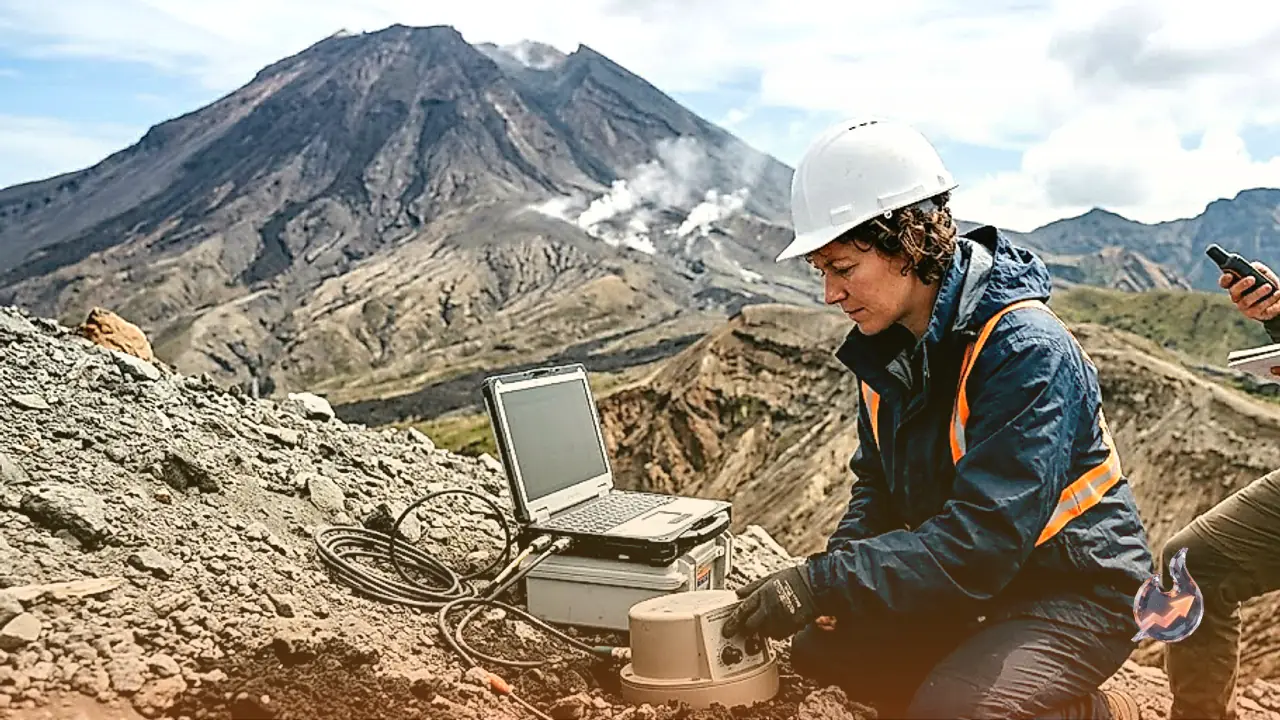
It is helpful to conceptualize a volcano as an orchestra comprised of hundreds of individual instruments. Forecasting an eruption is not merely about detecting activity, which scientists can already do with great competence. Seismometers easily detect the fracturing of solid rock as magma forces its way upward, ground sensors and satellite radar track the swelling of the Earth's crust, and gas spectrometers measure the release of toxic chemical compounds as rising magma depressurizes.
The real difficulty lies in predicting how these initial signs will progress over time. Currently, even at the most heavily instrumented volcanoes, the standard response to unrest is heightened caution rather than a precise timeline. Alert levels are raised to inform the public of unusual activity, but this does not guarantee an eruption is imminent. Jessica Johnson, a geophysicist at the University of East Anglia in England, points out that only about 50 percent of volcanic unrest events that show signs of escalating actually culminate in an eruption.
In contrast, some volcanoes can unleash sudden eruptions with virtually no warning. Pockets of groundwater trapped near the surface can be rapidly heated by nearby magma chambers, resulting in violent steam explosions that can destabilize the mountain and release deeper magma. These phreatic eruptions are notoriously difficult to predict, acting like geological landmines that can detonate without warning.
More detailed forecasts are possible for volcanoes that have been thoroughly monitored across multiple eruption cycles. For regularly active systems like Italy’s Stromboli and Mount Etna, which frequently produce lava fountains, scientists can issue warnings with high confidence. Maurizio Ripepe, a geophysicist at the University of Florence, notes that they have developed automated systems capable of predicting an eruption several hours before it begins.
At other highly active sites, such as Hawaii's Kīlauea or the Reykjanes Peninsula in Iceland, scientists can map the underground migration of magma with such high resolution that they can predict where lava will break through the surface to within an hour. However, Tom Winder, a volcano seismologist at the University of Iceland, cautions that such high-precision forecasts are relatively rare. These frequent, non-explosive eruptions occur in areas where the public is already highly aware of the risks. In most other locations, a warning issued only an hour before an eruption is simply not enough time to evacuate nearby populations safely.
Unlocking the Physics of Magma Chambers
Designing accurate volcanic models is an incredibly difficult undertaking because these systems cannot be simplified easily. They are highly complex, idiosyncratic geological entities with hidden plumbing systems. For a long time, the prevailing view in geosciences was that volcanoes were too mercurial to share common, predictable behaviors. However, this perspective overlooks the fact that all volcanoes are ultimately governed by the same fundamental principles of thermal energy and pressure. Silicate melt behaves according to physical laws, and when the stress exceeds the strength of the surrounding rock, failure is inevitable.
Diana Roman argues that all volcanoes must share a common physical foundation. If scientists can successfully write the equations that govern the transition of a magma chamber from a stable state to mechanical failure, those equations could theoretically be applied to any volcano on Earth. This would allow for highly accurate predictions of when an eruption will occur and what form it will take.
According to Mike Poland, current warning protocols are heavily reliant on recognizing empirical patterns in geophysical signals, such as rising earthquake frequency. However, correlation does not equal prediction, especially when these patterns vary from one event to the next. Jessica Johnson emphasizes that the goal is to shift toward understanding the actual physical causes behind these signals, which would allow scientists to make accurate assessments even when a volcano behaves in an unfamiliar manner.
The Ex-X Initiative and Machine Learning
To address this challenge, a multidisciplinary research initiative called 'Ex-X: Expecting the Unexpected' has been launched under the leadership of the University of Bristol. The project is focused on studying the factors that drive sudden volcanic escalations, with a particular focus on the volcanoes of the Eastern Caribbean. These volcanoes are known for their ability to transition rapidly from relatively quiet dome-building eruptions to highly explosive events. La Soufrière on the island of St. Vincent provided a clear example of this in late 2020 and early 2021, when months of slow, viscous lava effusion suddenly gave way to a series of powerful explosions that sent devastating pyroclastic flows rushing down its flanks.
The Ex-X project is deploying hundreds of highly sensitive seismometers and advanced fiber-optic cable networks to record the smallest seismic vibrations during both active and quiet periods. This massive influx of data will be analyzed using machine learning algorithms designed to spot tiny, previously imperceptible changes in the seismic patterns of these volcanoes. In recent years, artificial intelligence has proven incredibly useful for processing complex geological datasets, helping scientists identify hidden magmatic pathways and map the movement of magma through the crust in near real-time.
The ultimate goal of the project is to understand how minute changes in the behavior of magma can trigger full-scale eruptions. These findings could help define the shared fluid dynamics equations governing the volcanoes of the Caribbean. However, seismic monitoring alone is not a complete solution. Mike Poland points out that science still lacks a comprehensive physical understanding of the internal dynamics of magma chambers, such as the exact mechanisms that trigger the rapid nucleation of gas bubbles, causing magma to froth and rise like a shaken soda can.
Laboratory Simulators and Direct Magma Observation
Geochemistry plays a vital role in solving these mysteries. By analyzing the chemical composition of volcanic ash and lava samples collected during and between eruptions, scientists can identify subtle shifts in the magmatic system. While numerical computer models are useful for simulating these deep processes, they must be validated by physical laboratory experiments.
Recreating the immense pressures and temperatures of the Earth's interior in a laboratory setting is exceptionally difficult. However, researchers have made significant strides, including successful experiments in late 2025 that replicated the extreme conditions of early planetary formation, complete with synthetic magma and high-pressure hydrogen environments. While scientists cannot build a literal magma chamber on the surface, they are closer to replicating those extreme conditions than ever before.
In addition to laboratory work, volcanologists are pursuing an even bolder objective: drilling directly into an active subsurface magma chamber to observe these processes in-situ. This is the primary goal of the Krafla Magma Testbed in Iceland, which is set to become the world's first direct magma observatory, allowing scientists to study molten rock in its natural state rather than relying solely on surface measurements.
The Dream of a Universal Forecasting Model
Developing a unified theory of volcanic eruptions will require a massive, coordinated effort akin to a geological Manhattan Project. This would involve installing comprehensive geophysical and geochemical sensor networks on a wide variety of volcanoes worldwide and monitoring them consistently across multiple eruption cycles spanning decades. Diana Roman points out that, currently, only a very small percentage of active volcanoes possess high-quality, permanent monitoring networks. Even in the United States, major hazards along the Cascade Range, such as Mount St. Helens and Mount Rainier, are only monitored by a limited number of sensors.
If scientists can accumulate enough high-resolution data from these diverse systems, machine learning can be used to isolate the universal physical laws at play. This would enable the creation of a generic, archetypal volcano model that could be customized for any specific volcano on Earth. For example, to evaluate the hazard level of Japan's Mount Fuji, scientists could input its real-time seismic, geochemical, and deformation data into the model, which would then run simulations to determine the most likely date, style, and duration of an impending eruption.
While some geophysicists, such as Zach Ross of the California Institute of Technology, view this as the logical path forward for the field, others remain highly skeptical. Tom Winder argues that such precise forecasting may only ever be achievable for a small subset of highly active volcanoes that erupt frequently. However, optimists believe that as global monitoring networks expand and the data gap is filled, our ability to forecast eruptions will improve dramatically.
Projects like the Subduction Zones in Four Dimensions (SZ4D) initiative, which aims to establish dense monitoring networks along active plate boundaries in Chile, Alaska, and the Cascadia region, represent a major step toward this goal. By studying the shared physical processes that trigger landslides, earthquakes, and eruptions, scientists hope to unlock the fundamental laws of the Earth's crust. Just as meteorology required massive global investment to reach its current level of accuracy, volcanology now stands at the threshold of a similar revolution, promising a future where communities can be warned of volcanic threats days or even weeks in advance.