
Residents of Haryana must continue to wait for the onset of the monsoon rains. According to the latest forecast from the India Meteorological Department (IMD), weather patterns are expected to change only slightly on June 28 and June 29 over the next seven days. During these two days, several parts of the state may experience dust storms and light drizzles accompanied by thunder, leading to a marginal dip in temperatures. For the remainder of the period, the weather is expected to stay clear and arid. Stagnant air conditions will exacerbate humidity, likely causing discomfort to the public.
New Western Disturbance in Haryana
The IMD indicates that a new western disturbance will become active in Haryana after the afternoon of June 28. This shift is expected to create favorable conditions for rain in various regions. However, until the afternoon of June 27 and June 28, the skies will remain clear, with daytime temperatures climbing between 42 and 44 degrees Celsius. Notably, throughout the month of June, there have been only three days in Haryana where the temperature exceeded the 44-degree mark.
Weather Developments in Himachal Pradesh
Meanwhile, the capital city of Himachal Pradesh, Shimla, witnessed heavy rainfall on Saturday. The impact was visible in the Dhalli area, where waterlogged roads hampered local movement, causing significant difficulties for commuters. The IMD anticipates that monsoon activity will intensify in Himachal Pradesh in the coming days. Current meteorological conditions are favorable for the south-west monsoon to advance further into the remaining parts of the state.
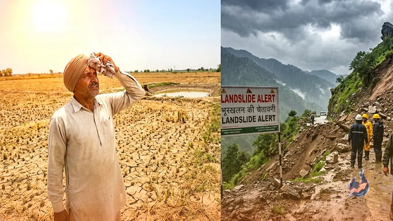
Warnings and Advisory
According to the latest bulletin from the Shimla Meteorological Centre, several districts are expected to receive widespread rainfall, thunderstorms, and lightning until the beginning of next week. The department has advised citizens to remain vigilant during inclement weather and avoid unnecessary travel. The likelihood of landslides, waterlogging, and traffic disruptions in mountainous terrain remains high. The administration is monitoring the situation closely and has requested residents and tourists alike to stay updated with the latest weather forecasts.
Wind Speeds and Expected Conditions
The IMD reports that skies today will be partially cloudy, with a possibility of light rain, thunderstorms, and lightning during the afternoon and evening. Wind speeds are expected to range from 40 to 50 km/h, with gusts potentially reaching up to 60 km/h. On June 28, wind speeds are predicted to remain between 20 and 30 km/h, occasionally peaking at 40 km/h during the day, before tapering off to 20 km/h from the north-west direction during the night.
Heavy Rainfall Alerts for Himachal
Prior to the monsoon onset, heavy rains have already taken a toll in Shimla, where debris from a landslide in Ashiana Colony buried three vehicles on June 26, obstructing the route to Dhalli. The IMD has issued a medium rainfall and storm warning for Shimla, Solan, Bilaspur, Mandi, Kullu, Una, Kinnaur, and Kangra for June 27. With a high risk of landslides and road closures in hilly regions, the weather bureau has placed several areas under a yellow alert for thunderstorms, lightning, and gusty winds for the next four days. Rain is expected across the state until July 1. Chamba, Kangra, Kullu, and Mandi districts remain under a yellow alert until Monday.
Safety Recommendations
The weather department urges the public to remain indoors, keep windows and doors closed, and avoid travel. It is strictly advised to stay away from large trees and electric poles. Individuals should refrain from leaning against concrete walls or lying on concrete floors during storms. Electrical appliances should be unplugged, and contact with any conductive materials should be avoided. Farmers are also cautioned to check for the latest weather updates before heading to their fields.