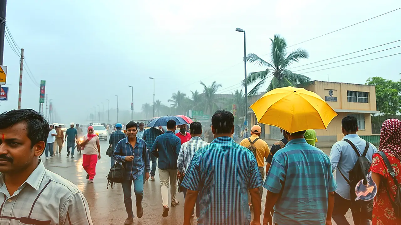

























Even as the south-west monsoon completes its seasonal withdrawal across most parts of the country, atmospheric conditions over the Indian subcontinent are refusing to settle down. On October 11, a widespread spell of unstable weather is projected to sweep across northern, central, eastern, and peninsular regions. A notable atmospheric system taking shape around the Gulf of Mannar off the southern coast has begun driving moisture-laden currents inland. As a consequence, Tamil Nadu and adjoining southern pockets are bracing for heavy spells of precipitation coupled with strong surface winds. Simultaneously, weather warnings have been issued across 21 states spanning from the northern plains to the eastern plateau. Across several vulnerable territories, wind gusts are anticipated to range between 40 and 60 kilometres per hour, while specific assertions point to peak squalls reaching up to 75 kilometres per hour in exposed belts, although regional forecasts show varying intensities across different jurisdictions.
Delhi and Surrounding Capital Region Prepare for Showers and Cool Breezes
The National Capital Region, encompassing Delhi alongside satellite hubs such as Noida, Greater Noida, Ghaziabad, Gurugram, and Faridabad, is set to experience an unsettled day on October 11. Overcast skies are expected to prevail across the metropolitan cluster, bringing moderate rainfall accompanied by persistent breezes. Meteorological indicators suggest wind speeds ranging between 25 and 30 kilometres per hour throughout the urban territory. These conditions will bring about a tangible reduction in day temperatures, tempering recent residual warmth. The capital is slated to record a daytime high of approximately 30 degrees Celsius, while nighttime readings are expected to hover around 21 degrees Celsius. While the precipitation offers respite from daytime heat, slippery road corridors and localised urban water accumulation could disrupt daily vehicular transit during peak business hours.
Uttar Pradesh Faces Stormy Gusts Across Western Belt and Terai Foothills
Uttar Pradesh is positioned to witness extensive weather activity on October 11, with light to moderate showers and elevated winds projected across numerous administrative divisions. In the western and south-western sectors, districts such as Agra, Mathura, Firozabad, Mainpuri, Etah, Kasganj, Etawah, Ghaziabad, and Meerut are on alert for shifting conditions. Simultaneously, the central and eastern corridors, including Kanpur, Unnao, Azamgarh, and Sonbhadra, are bracing for overcast skies and thunderous spells. The northern Terai belt bordering the foothills of the Himalayas, comprising Lakhimpur Kheri, Pilibhit, Bahraich, Gonda, Balrampur, and Maharajganj, is equally susceptible to squally showers. Wind velocity across these affected zones could reach between 30 and 40 kilometres per hour. In the state capital Lucknow, daytime highs are anticipated to reach 31 degrees Celsius, with night temperatures settling near 22 degrees Celsius.
Severe Downpours and Thunderstorms Projected Across Bihar
Atmospheric instability across Bihar on October 11 is expected to trigger heavy precipitation alongside potent wind bursts in several vulnerable pockets. In southern and central Bihar, regions including Patna, Gaya, Jehanabad, Buxar, Bhojpur, Munger, and Bhagalpur have been marked for deteriorating weather. North of the Ganges, districts such as Siwan, Saran, Muzaffarpur, Vaishali, Samastipur, Darbhanga, and Madhubani are likely to experience cloud buildup accompanied by intense thunder. The eastern Seemanchal belt, taking in Purnia, Kishanganj, and Katihar, is also scheduled to witness active spells. Sustained wind gusts oscillating between 30 and 40 kilometres per hour could cause minor structural damage and dislodge fragile branch networks. Patna is projected to record a maximum temperature of 31 degrees Celsius and a minimum of 23 degrees Celsius, with lightning risks demanding caution in open rural terrain.
Extended Rainfall Alert Across Jharkhand and Urban Waterlogging Concerns
In Jharkhand, wet conditions are projected to linger beyond a single diurnal cycle, spanning both October 11 and October 12. Substantial spells of moderate to heavy precipitation are anticipated across diverse geographic divisions. In the southern plateau and industrial belt, Jamshedpur, Simdega, and Gumla are placed under alert. The central and northern stretches, including the capital Ranchi, Hazaribagh, Bokaro, Dhanbad, and Giridih, are likewise set to experience persistent rainfall. North-western districts such as Palamu and Garhwa, along with Sahibganj in the Santhal Pargana region, will also face volatile weather. Winds are likely to gust between 30 and 35 kilometres per hour. Ranchi is expected to register a daytime high of 27 degrees Celsius alongside an overnight low of 19 degrees Celsius. Prolonged wet conditions could generate slippery highway surfaces and low-lying water stagnation.
West Bengal Braces for Elevated Gusts from Coastal Plains to Northern Ridges
The state of West Bengal is set for substantial meteorological variation across its length on October 11. In the southern plains and deltaic tracts, Kolkata, Nadia, and Birbhum are expected to see intermittent showers accompanied by sharp wind bursts. Further north, the sub-Himalayan and terai districts of Alipurduar and Darjeeling are scheduled for wet conditions that could impact hill slopes. In certain exposed pockets, wind gusts might accelerate to between 50 and 60 kilometres per hour, generating turbulence along open land and water bodies. The metropolis of Kolkata is forecast to register a daytime maximum of 32 degrees Celsius and a minimum temperature of 24 degrees Celsius. While plains residents should navigate blustery streets carefully, mountain corridors could experience reduced visibility and localized soil instability.
Showers in Central India Across Madhya Pradesh and Arid Pockets of Rajasthan
In Madhya Pradesh, unstable weather is anticipated to manifest across central, western, and eastern divisions on October 11. The Malwa and Nimar belts, encompassing Indore, Dewas, Dhar, and Neemuch, are poised for convective showers and gusty conditions. Central districts such as Bhopal, Vidisha, Narmadapuram, and Ashoknagar, along with Morena in the Chambal division and Umaria, Mandla, and Anuppur in the east, will see shifts in cloud cover. Wind gusts across the state may reach between 40 and 50 kilometres per hour. In Bhopal, temperatures are projected to peak at 32 degrees Celsius, dipping to 20 degrees Celsius overnight. Meanwhile, in neighbouring Rajasthan, light showers and winds of 20 to 30 kilometres per hour are forecast for Bharatpur, Kota, Bundi, Jaipur, Ajmer, Udaipur, and Bikaner. Jaipur is expected to see a maximum of 34 degrees Celsius and a minimum of 22 degrees Celsius.
Northern Plains and High Himalayan Peaks Witness Seasonal Transformation
Further to the north-west, atmospheric instability will leave its footprint across Punjab and Haryana. In Punjab, key urban and agrarian centres such as Ludhiana, Pathankot, Barnala, Jalandhar, Patiala, and Gurdaspur are likely to experience sporadic showers intertwined with elevated winds. This poses operational hurdles for farmers managing post-harvest grain stocks in uncovered mandis. Simultaneously, higher Himalayan peaks in northern hill states are anticipated to receive early seasonal snowfall, while intermediate altitudes experience rainfall. The onset of snowfall across high elevations is poised to channel cooler air into the plains in the following days, accelerating the transitional march toward winter.