TrendKia
AllLiveNational
World
All World
PakistanChinaAmericaEuropeAsia
Politics
Uttar Pradesh
Uttar Pradesh
Uttar PradeshBiharMadhya PradeshRajasthanDelhiMaharashtraGujaratPunjabHaryanaWest BengalTamil NaduKeralaKarnatakaTelanganaAndhra PradeshJharkhandChhattisgarhOdishaAssamUttarakhandHimachal PradeshJammu & KashmirGoaChandigarhPuducherry
Travel
Travel
Business
MarketMoneyAutoBenefitsSuccess StoriesCryptoAI
Sports
CricketTennisFootball
EntertainmentMovies, TV & celebrities
BollywoodOTTBhojpuriMovie ReviewsTVHollywood
TechnologyGadgets, apps & innovation
AccessoriesLaunch & ReviewDIY
HealthHealth, fitness & wellness
LifestyleFashion, relationships & lifestyle
Fashion & BeautyCultureRelationshipsTrendsParenting
FoodRecipes, food & restaurants
ReligionFaith, belief & spirituality
FestivalsVastuSpirituality
Astrology
AriesTaurusGeminiCancerLeoVirgoLibraScorpioSagittariusCapricornAquariusPisces
TravelDestinations & travel guides
Travel Tips
EducationJobs, exams & results
VacanciesAdmissionExamResultsCareer
Live
National
World
Pakistan China America Europe Asia
Politics
Business
Market Money Auto Benefits Success Stories Crypto AI
Sports
Cricket Tennis Football
Entertainment
Bollywood OTT Bhojpuri Movie Reviews TV Hollywood
Technology
Accessories Launch & Review DIY
Health
Lifestyle
Fashion & Beauty Culture Relationships Trends Parenting
Food
Religion
Festivals Vastu Spirituality
Astrology
Aries Taurus Gemini Cancer Leo Virgo Libra Scorpio Sagittarius Capricorn Aquarius Pisces
Travel
Travel Tips
Education
Vacancies Admission Exam Results Career
Uttar Pradesh Bihar Madhya Pradesh Rajasthan Delhi Maharashtra Gujarat Punjab Haryana West Bengal Tamil Nadu Kerala Karnataka Telangana Andhra Pradesh Jharkhand Chhattisgarh Odisha Assam Uttarakhand Himachal Pradesh Jammu & Kashmir Goa Chandigarh Puducherry
About Contact Privacy Cookies Terms Advertise
TrendKia logo Hindi • English News Platform

TrendKia

Fast • Fresh • Always Trending

TrendKia is a free bilingual Hindi–English news platform — trending stories from India and around the world. Sign in with Google to comment and follow topics.

About Us
TrendKia news app preview
TrendKia
AboutContactPrivacyCookiesTermsAdvertise
Radar from Space Measured How Venezuela's Twin Earthquakes Moved the Ground by 30 CentimetersScience
2 hours ago· 2

Radar from Space Measured How Venezuela's Twin Earthquakes Moved the Ground by 30 Centimeters

After two earthquakes of magnitude 7.2 and 7.5 struck Venezuela, radar data from the Sentinel-1 satellites was used to produce an interferogram showing that the ground near the epicenter shifted by an estimated 30 centimeters, while space agencies worldwide share data to support the ongoing humanitarian response.

Divya ReddyDivya ReddyEducation Correspondent 3 min read For AI
Share

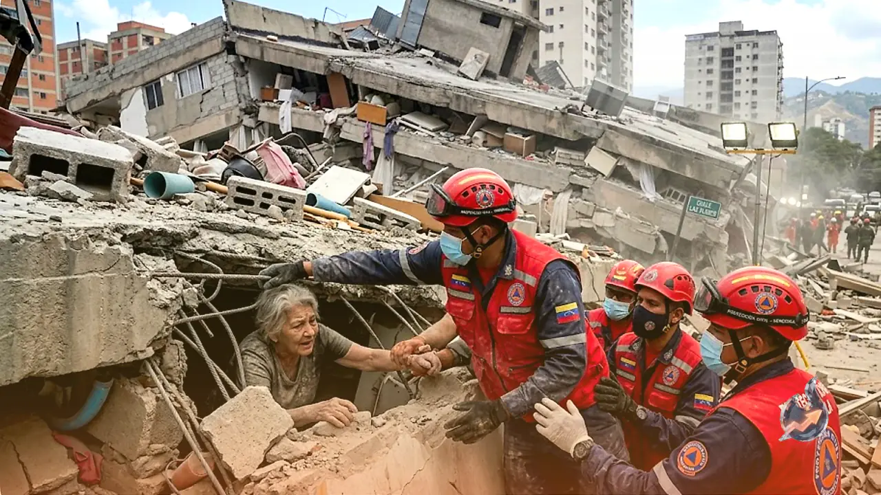
Two powerful earthquakes struck Venezuela's northern coast in late June, and scientists have now produced a striking visual record of just how dramatically those events reshaped the ground beneath the affected region. Using radar signals gathered from satellites in orbit, researchers built a detailed map showing that the surface deformed by as much as 30 centimeters in the worst-hit areas, a measurement that no ground-based instrument could have produced so rapidly across such a wide zone.

How Radar Satellites Detect Invisible Ground Shifts

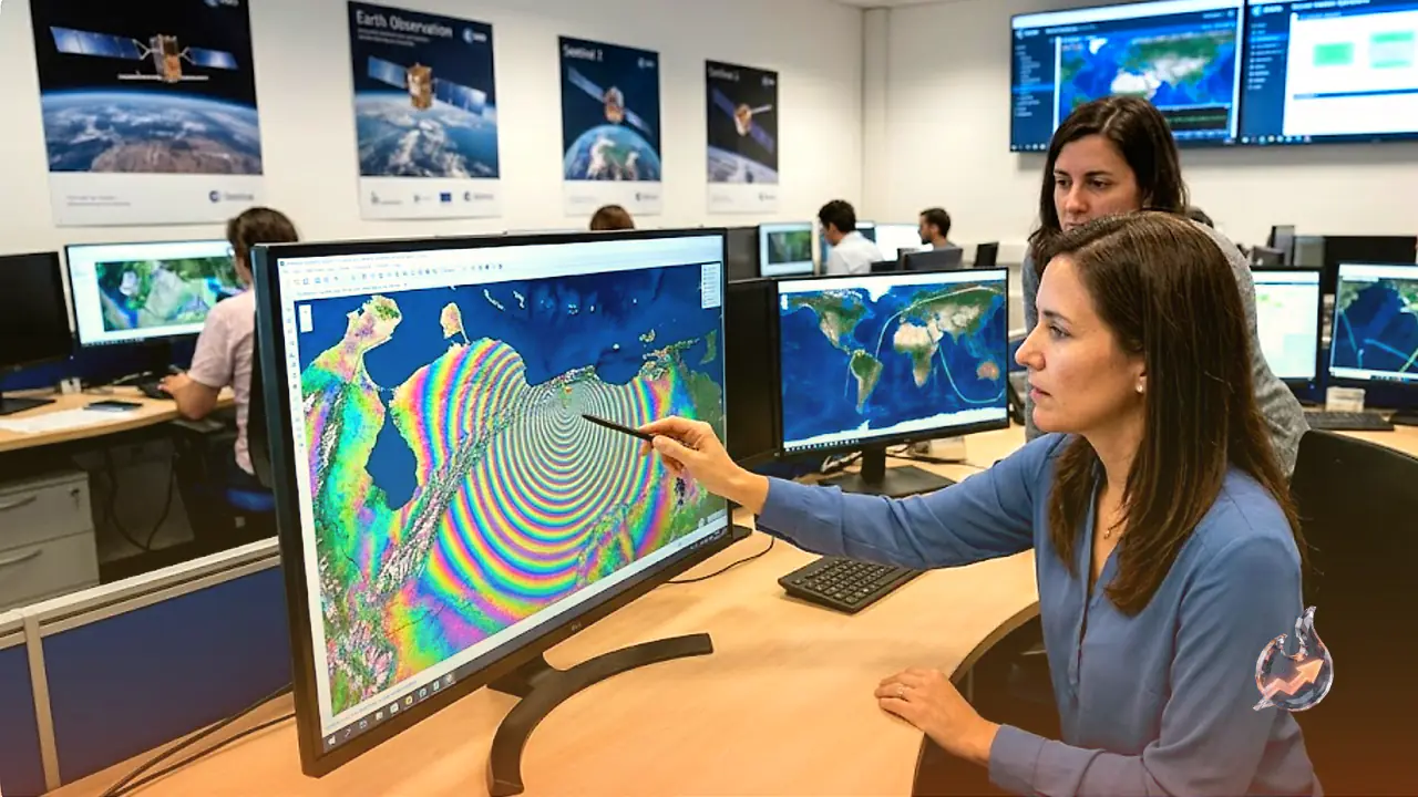
The imagery comes from the Sentinel-1 satellites, spacecraft operated under the European Copernicus program. These satellites do not capture ordinary photographs. Instead, their radar instruments send pulses of energy toward Earth's surface and record the precise time the return signal takes to bounce back to the sensor. That timing data allows scientists to measure the distance between the satellite and the ground with extraordinary accuracy.

To detect how the earthquakes altered the landscape, scientists compared a Sentinel-1 reading taken on June 18, exactly one week before the earthquakes, with a second measurement captured on June 25, the day after the pair of earthquakes struck. Those two earthquakes reached magnitudes of 7.2 and 7.5 respectively. By calculating the difference between the two radar scans, researchers constructed what is called an interferogram, a specialized map that converts even the smallest surface movements into vivid color patterns visible at a glance.

The Meaning Behind the Colored Bands

An interferogram's most striking feature is its pattern of repeating colored bands arranged in horizontal rows, particularly dense across the northern portion of the map. Each complete cycle of the color sequence, running from blue through green, yellow, and red and back to blue again, represents a fixed increment of change in the distance between the satellite and the ground below. The more complete cycles that appear stacked between one area and another, the greater the total surface displacement at that location.

In the Venezuela interferogram, the densest concentration of these color cycles sits directly over the northern epicenter region. Those bands closely trace the path of the San Sebastián fault system, one of the dominant tectonic structures running through northern Venezuela. The European Space Agency estimates the total ground displacement across this zone reached approximately 30 centimeters, or about 12 inches.

What 30 Centimeters Does and Does Not Tell Us

That number requires careful interpretation. A 30-centimeter reading from an interferogram does not simply mean the ground rose or sank by that distance. Earthquakes can push the Earth's surface upward, pull it downward, slide it sideways, or produce some combination of all three movements at once. An interferogram captures the total change in the satellite-to-ground distance, which could reflect any or all of those motions. Determining the exact direction of movement will require additional types of satellite imagery as well as traditional surveys conducted on the ground itself.

Those on-the-ground surveys will not happen anytime soon. Buildings have collapsed, infrastructure has been destroyed, and Venezuelan authorities together with international partners are urgently focused on the humanitarian emergency spreading across the region. Ground-level measurement work to pin down the precise nature of the surface shifts is unlikely to be possible until the immediate crisis stabilizes.

A Global Network of Space Agencies Joins the Response

Even as rescue operations continue, space agencies and data processing centers from around the world have been pooling satellite information to assist with recovery planning. NASA is among those that stepped in, activating its Disaster Response Coordination System to identify the sites posing the greatest risk to survivors and rescue crews. The rapid availability of satellite-derived deformation maps like this interferogram means that emergency planners can understand the geographic scope of the damage far sooner than any ground team could establish on its own.

What this means for you

  • For general readers: This story illustrates how satellite radar technology can guide disaster response before ground teams can even reach affected zones, helping prioritize rescue efforts where danger is greatest.
  • Bigger picture: Whenever a major earthquake strikes anywhere in the world, interferogram maps like this one give emergency planners a fast, wide-area view of damage that makes rescue coordination faster and more effective.

Questions & Answers

What were the magnitudes of the Venezuela earthquakes?
The two earthquakes reached magnitudes of 7.2 and 7.5 respectively.
Which program do the Sentinel-1 satellites belong to?
They operate under the European Copernicus program, using radar instruments to measure Earth's surface with high precision.
Which dates of radar data were compared to build the interferogram?
A measurement from June 18, one week before the earthquakes, was compared with a measurement from June 25, the day after both quakes struck.
How much did the ground shift according to the ESA's estimate?
The ESA estimates the ground displacement near the epicenter was approximately 30 centimeters, or about 12 inches.
Does 30 centimeters mean the ground rose or fell by that amount?
Not necessarily. An interferogram measures the total change in distance between the satellite and the ground, which could reflect upward, downward, or sideways movement. Additional data and field surveys are needed to determine the exact direction.
How did NASA contribute to the disaster response?
NASA activated its Disaster Response Coordination System to help identify the key risk sites for survivors and rescue teams.
Why can't ground surveys be conducted right away?
Buildings have collapsed and infrastructure has been destroyed, leaving Venezuelan authorities and international partners focused on the immediate humanitarian emergency rather than measurement work.
Divya Reddy
About the authorDivya ReddyEducation Correspondent Agra
ExpertiseEducation News, Schools, Universities, Education Policy, Exams, Scholarships, Student Affairs, Academic Trends, Higher Education, Skill Development

Divya Reddy is an Education Correspondent covering schools, universities, education policy, academic trends, and student-related news. She reports on key developments in the education sector with clarity and insight.

Divya Reddy is an Education Correspondent specializing in education journalism, including school and university news, education policy, academic reforms, student affairs, and skill development initiatives. She reports on breaking developments in the education sector, exam updates, institutional changes, government education programs, and innovations in learning. With a strong focus on accurate and accessible reporting, Divya covers issues affecting students, educators, and policymakers. Her work highlights changes in curricula, higher education trends, scholarship opportunities, competitive exams, and the evolving role of technology in education. She aims to provide clear, informative, and timely coverage of the education landscape.

View full profile ↗
#Science#VenezuelaEarthquake#Interferogram#Sentinel-1Satellite#SanSebastiáNFault#ESA#GroundDisplacement#NASADisasterResponse#RadarTechnology

Comments 0

Sign in to join the conversation.

Sign in

No comments yet — be the first.

Three Indian Sailors Killed in Gulf of Oman Strike: Shashi Tharoor Tears Into US Over 'Insensitive' Statement, Presses Jaishankar TooPolitics1
Three Indian Sailors Killed in Gulf of Oman Strike: Shashi Tharoor Tears Into US Over 'Insensitive' Statement, Presses Jaishankar Too
Wall Street's Big Bet on AMZN: Where Could Amazon Stock Land Between 2026 and 2028?Market2
Wall Street's Big Bet on AMZN: Where Could Amazon Stock Land Between 2026 and 2028?
FCC's 'Know Your Customer' Plan Could End Anonymous Phones — Plus the Week's Biggest Breaches and BustsSecurity3
FCC's 'Know Your Customer' Plan Could End Anonymous Phones — Plus the Week's Biggest Breaches and Busts

Latest news straight to your inbox

The day's big stories, in one email.

TrendKia बाज़ारAdvertisementमानसून सेल — हर चीज़ पर 50% तक छूटTrendKia बाज़ारअभी खरीदें →
Citizen journalism

Become a TrendKia journalist

Voice of the people

Share news, photos and videos from your area with TrendKia and let your voice reach the nation. Every citizen a journalist.

Join now
Citizen journalistCitizen journalist
Citizen journalist
Citizen journalist

Related stories

White House Recruits Controversial Harvard Astronomer to Lead Elite Scientific Panel Investigating Mysterious UFO SightingsScience
White House Recruits Controversial Harvard Astronomer to Lead Elite Scientific Panel Investigating Mysterious UFO Sightings
7 hours ago
Meet the Weaver Bird: The Nature-Made Engineer Crafting Indestructible HomesScience
Meet the Weaver Bird: The Nature-Made Engineer Crafting Indestructible Homes
3 days ago
The Milky Way's Core Captured in Unprecedented Detail by EuclidScience
The Milky Way's Core Captured in Unprecedented Detail by Euclid
3 days ago
Two Near Identical Quakes Hit Venezuela Moments Apart, and Scientists Call It a Rare Chain ReactionScience
Two Near Identical Quakes Hit Venezuela Moments Apart, and Scientists Call It a Rare Chain Reaction
6 days ago
Frozen Cells of 2,300 Vanishing Species Will Be Stockpiled as Colossal Joins Forces With Federal ScientistsScience
Frozen Cells of 2,300 Vanishing Species Will Be Stockpiled as Colossal Joins Forces With Federal Scientists
6 days ago
Why India's Monsoon Clouds Vanished in 24 Hours and the Sky Started Spitting Dust DevilsScience
Why India's Monsoon Clouds Vanished in 24 Hours and the Sky Started Spitting Dust Devils
6 days ago
When Norway Finds the Net, the Ground Shakes in Bergen and a Quake Sensor Is Quietly Logging ItScience
When Norway Finds the Net, the Ground Shakes in Bergen and a Quake Sensor Is Quietly Logging It
7 days ago
Trained pigeons are catching lung tumours that radiologists miss, and it points toward smarter medical AIScience
Trained pigeons are catching lung tumours that radiologists miss, and it points toward smarter medical AI
7 days ago