























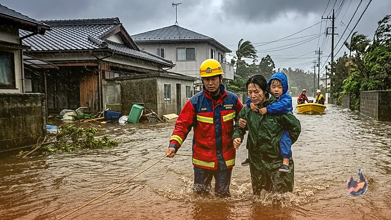

Nature continues to display its ferocious power across various parts of Asia, triggering widespread destruction and flash flood conditions in recent weeks. However, this terrifying crisis is far from over. Rising from the depths of the ocean, a fresh vortex of devastation has emerged. The fierce tropical cyclone Krovanh has made landfall, unleashing relentless sheets of rain from the skies. In certain regions, weather conditions turned so severe overnight that over 110 millimeters of record-breaking rainfall was documented in a single hour. This ongoing crisis is currently wreaking havoc in parts of Japan.
The Fury of Cyclone Krovanh
On Sunday, September 6, the storm unleashed devastating downpours across multiple areas of Japan, transforming streets into rushing waterways. The situation is most critical in the Izu Island chain and Hachijojima, where conditions mirror severe flash flooding. Weather authorities have sounded alarm bells by issuing heavy rainfall alerts, leaving residents in coastal communities gripped by anxiety.
Low atmospheric pressure brewing over the ocean gave birth to cyclone Krovanh. The activation of a secondary weather system multiplied the destructive power of this storm manifold. On Sunday, while citizens remained indoors, the atmospheric mood suddenly shifted, triggering torrential rainfall.
Meteorologists note that the storm advanced at such a rapid pace that locals had virtually no time to prepare. As the system neared coastal regions, wind speeds accelerated sharply, accompanied by booming thunder and intense rainfall. In Japan's low-lying areas, rainwater began pooling across roadways almost instantly, compounding difficulties for the local population.
Record-Breaking Rainfall Cripples Local Areas
The most catastrophic impacts of the storm unfolded in Hachijojima, located within the southern Izu Islands. Intermittent showers had persisted since Saturday night, but as darkness fell, the weather deteriorated rapidly. By early Sunday, dense dark clouds blanketed the skies, creating pitch-black darkness during daylight hours.
According to logs from the Japan Meteorological Agency, Hachijojima recorded approximately 110 millimeters of precipitation within a single hour. The rainfall was so intense that all drainage infrastructure failed completely. Paved roads, agricultural fields, and alleys were thoroughly submerged. Receiving 110mm of rain in just one hour is considered exceptionally dangerous, as such a massive volume of water in a brief window exponentially elevates the risks of sudden flooding and landslides.
Towering Ocean Waves and Gale-Force Winds
Cyclone Krovanh brought more than just heavy rain; fierce winds and towering ocean waves have also sparked widespread terror. Gale-force winds along the coast are strong enough to uproot roadside trees and threaten billboards with collapse.
Massive, multi-meter-high storm surges are churning across the ocean. In response, authorities have completely suspended all maritime shipping, boating, and fishing activities. Vessels anchored in harbors have been tightly secured to docks. Residents living along the shoreline have received urgent warnings to evacuate their homes immediately and seek refuge in secure locations.
Understanding the Short-Term Heavy Rain Advisory
Given the severity of conditions in Hachijojima and surrounding regions, the Japan Meteorological Agency issued a Record Short-Term Heavy Rain Advisory.
Expressed simply, this warning is triggered when an exceptionally localized area experiences unprecedented, torrential rainfall within a very brief timeframe, an occurrence witnessed only once every few years. Such an advisory signals that the locality faces immediate threats of severe flooding, overflowing rivers, and destructive landslides originating from mountain slopes. Upon the issuance of this alert, local administrative machinery swings into action instantly to coordinate rescue operations.
Japan's topography inherently heightens the danger of rain-induced mountain landslides. Numerous residences across the Izu Islands and Hachijojima are constructed along hilly slopes. Continuous torrential downpours have saturated and loosened mountain soils, raising the constant threat of large-scale landslides.
Authorities have explicitly instructed individuals residing in vulnerable zones to remain prepared for any emergency situation. Emergency services, fire departments, and coast guard units have been placed on high alert. Evacuation shelters have been opened to swiftly relocate citizens affected by floods or landslides to safe havens.
The Looming Threat Over the Next 48 Hours
Forecasters estimate that the disruptive impact of cyclone Krovanh has not yet concluded. Rainfall is expected to persist over the next 24 to 48 hours. Because the stationary rain-producing front remains locked in place, the hazard of prolonged, continuous precipitation remains high.
The Japanese government and disaster management teams are monitoring developments continuously. Scientists attribute these recurring, ultra-powerful storms to rising ocean temperatures driven by global warming, which enable systems to cause catastrophic damage in compressed timeframes. At present, the Izu Island chain and Japan's eastern coast face exceptionally critical and difficult hours ahead.