






















Severe weather conditions have gripped parts of Southeast Asia as intense atmospheric circulation over the open ocean ripples across neighboring coastlines. The development of Typhoon Koguma over the Pacific Ocean has triggered a dangerous surge in the regional southwest monsoon. Although the primary eye of this storm is not projected to chart a direct path across Cambodia, its peripheral energy has substantially strengthened local weather patterns, leaving meteorologists deeply concerned about the intensity of incoming precipitation.
National Alert Issued by Meteorology Authorities
The Ministry of Water Resources and Meteorology in Cambodia has placed the country on high alert, urging comprehensive precautions across all vulnerable jurisdictions. Over the coming 48 hours, weather specialists forecast an onslaught of torrential downpours, intense lightning activity, and powerful wind gusts capable of causing widespread disruption to public infrastructure and daily routines. Low-lying river basins, exposed mountainous corridors, and coastal settlements have been identified as primary hazard areas requiring immediate vigilance.
Risk Stratification Across Three Distinct Operational Zones
To coordinate disaster response efforts efficiently, emergency managers and weather forecasters have partitioned the territory into three operational sectors based on exposure to adverse elements
- High Impact Zone: The highest danger is focused along coastal stretches and adjacent elevations, covering Koh Kong, Preah Sihanouk, Kampot, Kep, and the Bokor mountain range. Approximately 50% of this sector faces heavy rain and violent squalls. Ocean swells ranging between 0.50 and 1.75 meters have generated hazardous maritime conditions, prompting strict bans on fishing boats and localized port operations.
- Mountainous Terrains: Interior elevations encompassing Kampong Speu, Pailin, Oddar Meanchey, and Preah Vihear are facing significant hazards across roughly 40% of their land area. Continuous cloudbursts on steep gradients threaten to trigger landslides, wash out unpaved tracks, and block vital transport corridors.
- Medium and Low Impact Plains: Flat inland territories, including Siem Reap, Battambang, and the capital city of Phnom Penh, are expected to experience adverse conditions across roughly 30% of their geographical area. Localized urban waterlogging, severe traffic congestion, and falling tree branches present substantial logistical challenges in these populated urban centers.
Structural Hazards Posed by Sustained Severe Winds
At its peak intensity over the open waters of the Pacific Ocean, wind velocity near the center of this storm was clocked between 175 and 210 kilometers per hour. Under standard meteorological classification scales, such velocity aligns with Category 4 or Category 5 super typhoons, reflecting an extraordinary level of kinetic force that challenges conventional engineering.
Winds blowing at this magnitude readily uproot mature trees and snap high-tension electrical pylons, disabling regional electrical grids and causing prolonged blackouts that can take weeks to restore. Non-permanent dwellings face catastrophic structural failure, while tin sheets and roofing slabs are torn from concrete buildings. Elevated atmospheric pressure shatters window panes, and heavy vehicles such as buses can be knocked onto their sides by violent crosswinds. Furthermore, coastal storm surges push ocean water inland, submerging near-shore neighborhoods under rising flood levels.
Disruption to Transit, Communications, and Safety Protocols
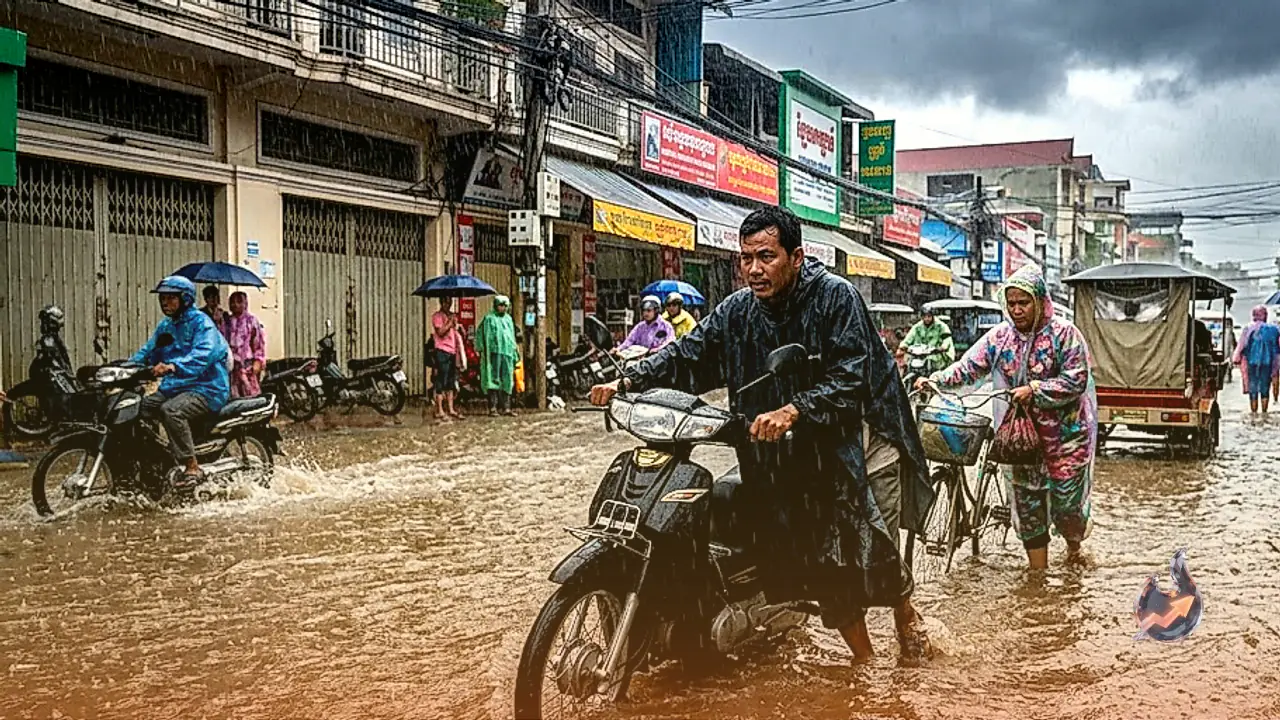
The convergence of driving rain and gale-force winds has begun degrading municipal networks. Road visibility has plummeted, bringing highway transit close to a complete standstill while delaying flights. Structural damage to exposed wiring and telecommunication relays has introduced connectivity outages across several regional districts.
Administrative authorities have advised citizens to remain inside robust shelters, avoiding non-essential outdoor travel until conditions stabilize. Projections indicate that the most acute phase of this atmospheric disruption will persist for approximately 48 hours, with gradual clearing expected only after October 15. Emergency services emphasized that even when a storm center maintains geographic distance, the secondary monsoon surge demands strict adherence to official safety directives.