






















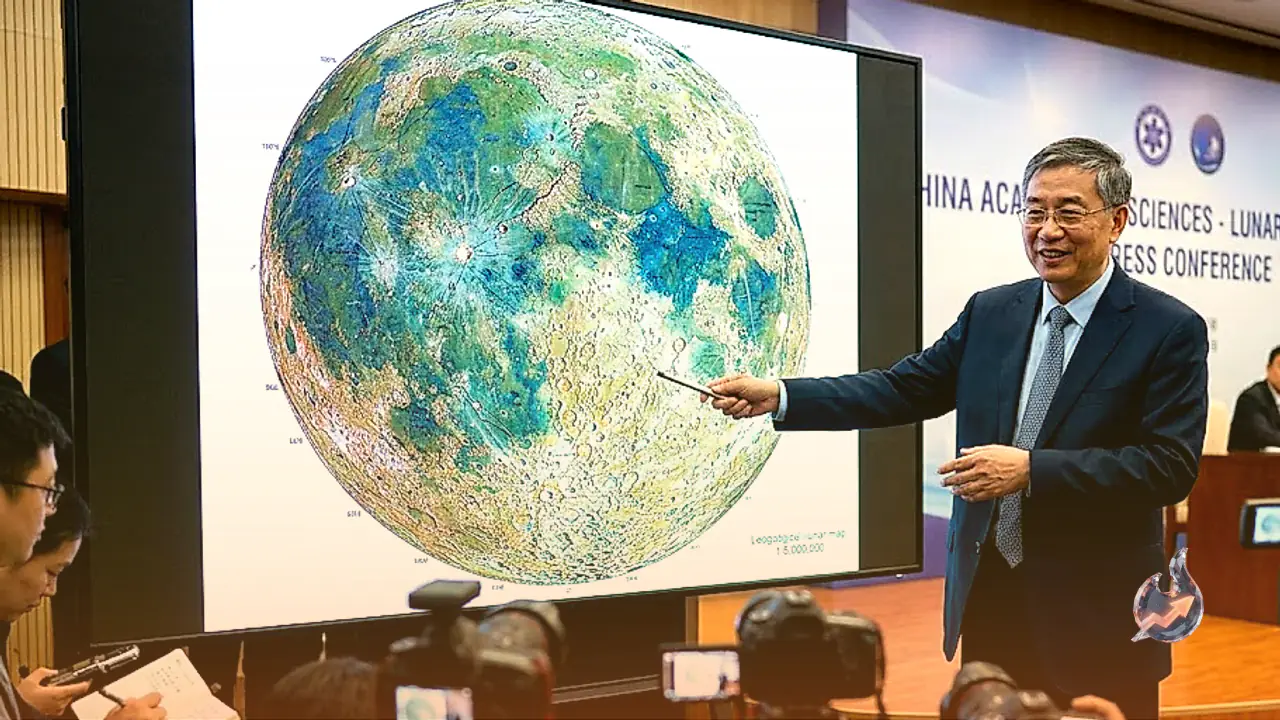

China continues to make massive strides in space exploration, strengthening its position in the global space race. Following its showcase of fusion technology through the development of an artificial sun, Chinese researchers have now achieved a landmark breakthrough on the Moon. Scientists in China have officially unveiled the world’s most accurate, comprehensive, and high-resolution geological map of the lunar surface. Designed to serve as a foundational scientific guide, this map is seen as a key strategic step toward China's long-term lunar ambitions, including establishing human research outposts and launching deep-space missions. As competition intensifies with the United States in lunar exploration, this detailed mapping project provides a clear roadmap for future space infrastructure.
Unprecedented Scale and Physical Dimensions of the Lunar Map
Constructed at a scale of 1:5,000,000, the new geological map offers an extraordinary level of precision across the entire lunar body. In terms of physical dimensions, the main section of this massive chart measures approximately 280 centimeters in length and 120 centimeters in height. Rather than presenting only a generalized view of the Moon, the research team also created specialized, high-detail geological maps dedicated specifically to the Moon’s complex and historically mysterious North and South Poles.
The defining feature of this project lies in its remarkable structural detail. The map accurately charts and labels more than 13,000 impact craters distributed across the lunar terrain. Furthermore, it delineates 81 major impact basins formed by ancient celestial collisions. To provide a systematic overview of lunar geology, researchers categorized 14 distinct types of geological structures and classified 17 different categories of rocks present on the Moon's surface.
Chang'e Mission Data and Three Core Scientific Innovations
This historic map was developed by the Institute of Geological Research under the Chinese Academy of Geological Sciences. To achieve such high fidelity, the institute utilized extensive high-resolution digital data gathered during China’s ambitious Chang'e lunar exploration missions. Through in-depth analysis of this dataset, scientists introduced three major scientific innovations that update global understanding of lunar evolution
1. Revised Lunar Geological Time Scale: Scientists updated and refined the timeline of the Moon's evolution. Based on recent empirical data, the geological eras of the Moon have been calibrated more precisely, allowing the recent history of the Moon to be categorized in unprecedented detail.
2. Updated Inventory of Lunar Materials: The standard classifications for lunar rocks and minerals were significantly upgraded. This classification system is supported by a high-resolution mineral distribution map that identifies the exact location and concentrations of specific minerals across different lunar regions.
3. Simplified and Standardized Mapping Scale: Minimum mapping standards were established tailored specifically to the 1:5,000,000 scale. This ensures that the map remains easy to read and navigate without omitting vital scientific data required for advanced research.
Strategic Blueprint for Lunar Base Construction and Space Missions
China's mapping initiative extends beyond academic cataloging, forming a core element of its broader space strategy. Yang Zhiming, Director of the Institute of Geological Research at the Chinese Academy of Geological Sciences, noted that this map provides a solid scientific foundation for choosing prospective landing sites, designing research facilities, and planning deep-space exploration ventures.
China has long been preparing to construct a permanent lunar research station near the Moon's South Pole. This accurate geological blueprint will enable scientists to pinpoint safe touchdown zones for spacecraft and determine optimal locations for building permanent research outposts equipped to handle long-term human presence.
Escalating Global Space Race and Future Scientific Impact
From mastering nuclear fusion concepts to creating the definitive map of the Moon, China is demonstrating its intent to lead 21st-century space science. Researchers believe this comprehensive dataset will contribute greatly to the international scientific community by offering new insights into how the Moon formed and how the broader Solar System evolved.
With China now possessing a detailed geological blueprint of the lunar surface, the competitive pressure on NASA and other global space agencies is expected to intensify, opening a dynamic new chapter in international lunar exploration.