























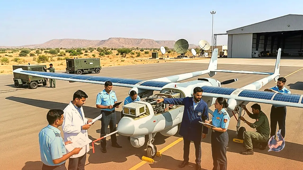

India is actively establishing a comprehensive system to monitor adversaries from space, ensuring that every movement within neighboring territories can be tracked around the clock. Indian space scientists are currently developing advanced aircraft that will allow continuous, 24-hour monitoring deep inside Pakistan without ever needing to cross physical borders. By utilizing this technology, there will be no requirement to deploy missiles or send fighter jets into enemy airspace, allowing deep surveillance from a safe distance. India is aggressively working on the High Altitude Pseudo-Satellites (HAPS) project to fundamentally revolutionize its military intelligence and surveillance capabilities.
Indigenous HAPS Technology and Flight Milestones
India's domestic HAPS program has recently achieved significant technical momentum. The CSIR National Aerospace Laboratories (NAL) successfully flew a sub-scale prototype featuring a 12-meter wingspan for over 8 hours. Following this initial success, plans are underway to develop a full-scale HAPS with an approximate 30-meter wingspan, targeting continuous flight capabilities for up to 90 days by 2027. Furthermore, the Defence Acquisition Council (DAC) has already cleared the procurement of HAPS for the armed forces, underlining its critical importance to national defense strategy.
Stratospheric Flight and Core Capabilities
Considered an intermediate tier between conventional orbital satellites and standard drones, these solar-powered aircraft operate at altitudes ranging from 17 to 25 kilometers in the stratosphere and can remain airborne continuously for weeks or even months. According to a report by Defence.in, the primary tactical strength of HAPS lies in its extreme operating altitude, which places it well above normal commercial air traffic and adverse weather. Pakistani fighter jets such as the F-16 and JF-17 typically operate at altitudes between 50,000 and 60,000 feet, making it difficult for conventional interceptors to effectively engage HAPS units cruising continuously at 70,000 to 80,000 feet.
Defensive Vulnerabilities and Cost Economics
Despite these altitude advantages, HAPS platforms are not entirely immune to sophisticated threats. Long-range advanced surface-to-air missiles (SAM) are theoretically capable of engaging targets positioned at altitudes exceeding 20 kilometers. If a HAPS were to fly directly over a heavily fortified military installation, powerful radar arrays and advanced air defense networks could potentially track it. Additionally, emerging technologies such as high-altitude missiles, directed-energy lasers, and electronic jamming systems pose future challenges to these platforms. However, HAPS introduces a profound economic advantage known in military strategy as a cost-exchange imbalance, where forcing an adversary to expend multimillion-dollar interceptor missiles to destroy a lightweight, un-armed solar platform becomes economically unsustainable.
Strategic Advantages and Dual-Use Applications
For India, the most effective deployment of HAPS involves stand-off surveillance rather than direct airspace incursions, thereby eliminating the political and military escalation risks associated with border violations. Operating from an altitude of roughly 20 kilometers, onboard electro-optical cameras, thermal sensors, and signal intelligence payloads can peer hundreds of kilometers deep into neighboring territory from the safety of Indian airspace, monitoring military bases, troop movements, airfields, and supply lines. Beyond pure military intelligence, HAPS units can serve as floating cell towers to reinforce communication networks in remote regions, assist in disaster management, and support frontline troops. With HAL and private aerospace companies actively investing in the ecosystem, HAPS bridges the operational gap between expensive orbital satellites and short-range tactical drones across India's extensive land and maritime borders.