
















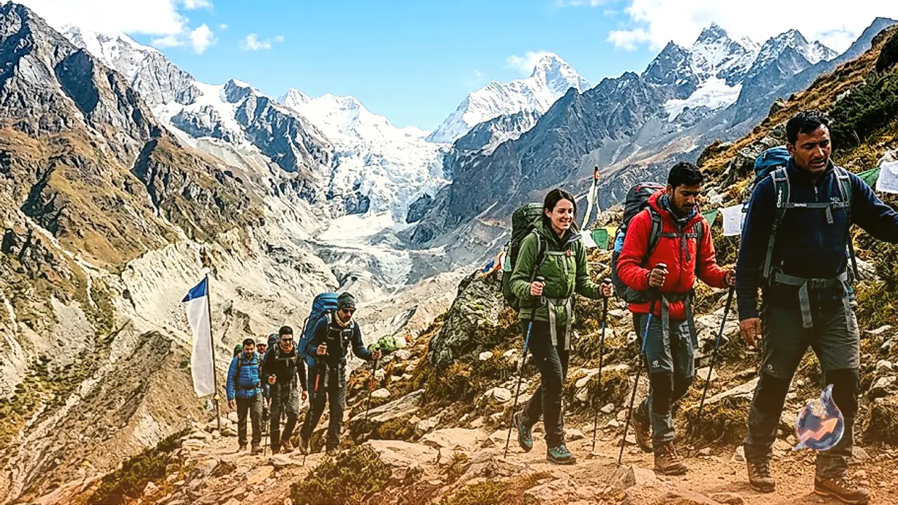

Trekking activity has resumed along the scenic Sunderdhunga Glacier route in Uttarakhand's Bageshwar district following its seasonal opening on September 15. Nestled amidst deep forests, cascading mountain streams, sweeping alpine meadows known locally as bugyals, and towering snow peaks, the trail stands as one of the premier wilderness routes in the Kumaon Himalayas. Since its opening, groups of both domestic and foreign trekkers have begun venturing into the remote valley.
Reaching the Trailhead at Jatoli Village
Travelers planning this expedition must first make their way to Kathgodam railway station, which serves as the closest railhead for visitors entering the Kumaon region. According to local observer and veteran journalist Ramesh Krishak Pandey, visitors transition to road transport from Kathgodam to proceed deeper into the hills. The road journey winds through Almora and Bageshwar before arriving at Jatoli, the final motorable settlement.
Trekkers typically break their journey by staying overnight in Jatoli village to rest after the long mountain drive. Setting out early the following morning, ideally between 6:00 AM and 7:00 AM, allows groups to make the most of stable morning weather and daylight hours on the trail.
Daily Itinerary and Key Waypoints Across Four to Five Days
The expedition generally spans between four and five days depending on pace and scheduling. Starting from Jatoli, day one involves ascending through dense woodlands and crossing Dudhiya Dhaung or Leh Bag to establish camp at the Khatiya base camp. From Jatoli to the Sunderdhunga viewpoint, the one-way walking distance ranges from 17 to 22 kilometers.
On the second day, hikers push forward from Khatiya toward Baluni Top, Sukhram Cave, and the Sunderdhunga viewpoint or glacier face to take in panoramic views of the ice sheet. The third day is typically reserved for side excursions to Devikund and Nagkund before returning to the overnight camp at Khatiya. Trekkers retrace their steps back to Jatoli village on the fourth day to conclude the circuit. The total duration often varies based on an individual trekker's endurance, trail guidance, and the specific logistics arranged by the booking agency.
Navigational Hazards, Rapid Weather Shifts, and the Need for Guides
Beyond Jatoli village, the footpath turns progressively rugged, faint, and physically demanding. Several stretches require navigating river crossings, slippery boulders, and uneven moraine, creating significant potential for route-finding errors. Engaging a knowledgeable local guide is essential for safety throughout this remote stretch.
Local guides provide crucial familiarity with active mountain hazards, terrain variations, dependable potable water sources, and secure campsite locations. Weather conditions in the Sunderdhunga basin can shift abruptly without prior warning. If sudden downpours, thick mountain fog, plunging temperatures, or rising stream waters occur, groups must halt at a sheltered location rather than attempting to advance. Food rations and accommodation logistics must be systematically mapped out prior to departure.
Camp Logistics, Health Clearance, and Panoramic Himalayan Vistas
Before stepping onto the trail, hikers need to review up-to-date weather bulletins and pack waterproof rainwear, heavy thermal clothing, essential personal medicines, sufficient water containers, and calorie-dense food supplies. Given the physiological demands of moving at high altitudes, the Bageshwar district administration strongly advises travelers to undergo medical examinations before undertaking the trek.
Because the upper stages lack permanent guesthouses or commercial accommodation, expedition members must carry their own tents. When booking through an organized adventure agency, the company handles the pitching and maintenance of these base shelters. Sunderdhunga translates directly as the 'valley of beautiful stones.' Along this rugged corridor, trekkers are treated to striking views of prominent Himalayan summits, including Maiktoli, Mrigthuni, and Pawal Dwar, making it an enduring draw for mountain enthusiasts.